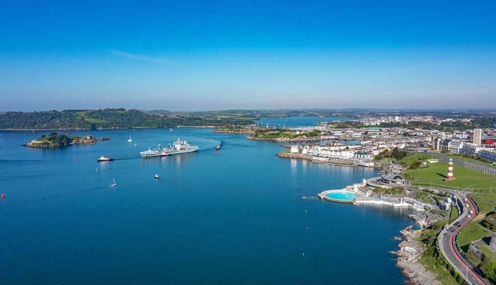
Plymouth is built for walking by the water, and the easiest way to see it is by following the South West Coast Path. The national trail runs 630 miles from Minehead to South Haven Point, and the Plymouth section alone covers 76 miles with 16,084 feet of ascent. A manageable stretch of it links Cremyll Ferry, Royal William Yard, Plymouth Hoe, The Barbican and Mount Batten Pier, and takes roughly three to five hours to complete on foot.
Every week we pick 🏆 the 5 best 🏆 things to do in Plymouth and send them to your inbox. Just one weekly email, no spam.
By submitting your email, you accept our Privacy Policy
Start at Plymouth Hoe, a Grade II registered historic park and one of the city's best-known spaces, with wide asphalt paths that work for wheelchairs and prams. It looks out over Plymouth Sound, one of the world's finest natural harbours, and is the spot where Sir Francis Drake is said to have played bowls before sailing to face the Spanish Armada in 1588. Along the way you'll pass the Royal Citadel, a 17th-century fortress that still houses the 29 Commando Royal Artillery, and Smeaton's Tower, the lighthouse rebuilt from its original base 14 miles out to sea. There's a massive granite and limestone breakwater weighing 4.5 million tonnes, facilities are free and open round the clock, and public toilets sit near Valenti's Cafe on Hoe Road. In the quieter months, West Hoe offers a calmer path with views across to Drake's Island and a good spot for winter sunsets.
Royal William Yard is the next natural stop, a former naval victualling depot in Stonehouse that now holds Europe's largest collection of Grade I listed military buildings. Designed by Sir John Rennie and built between 1824 and 1835 to supply the Royal Navy, the site keeps the Brewhouse, Slaughterhouse, Mills Bakery and the grand Melville Block. A free, self-guided discovery trail opened there on 9 August 2025 and walks you through two centuries of history. If you're into geology, there's also a Royal William Yard Geo Trail you can pick up at the Gatehouse, which uses QR codes to tell the story of the ground beneath your feet.
Over at Mount Batten Pier, the path meets the ferry to Drake's Island, the fortified island sitting about 500 metres offshore and named after Sir Francis Drake, who became governor there after circumnavigating the globe. Tours run with well-behaved dogs on a lead, the ferry is £23 an adult, and the island takes visitors from March to October. For something more active, a 2.5km paddleboarding route of moderate difficulty starts from Firestone Bay.
If you want to push further, the Cremyll Ferry crosses from Admirals Hard in Stonehouse to Cremyll Quay in seven or eight minutes, and lands you at Mount Edgcumbe Country Park on the Rame Peninsula, 865 acres with a house first built in the 16th century. The ferry runs every half hour, and in the winter schedule that's now in place it's 08:00 to 18:15 on weekdays and 09:00 to 18:15 at weekends, at £3.00 for adults and £2.00 for children aged 3 to 15. For anyone who wants to plan their route properly, the Plymouth Trails app gives real-time maps, text stops, images, videos and 'Now & Then' overlays, so you can see how the coastline has changed over the years.
Published Date
7 October 2026
More information